Abinger Magnetic Observatory (1924-1957)


Abinger Observatory was established in 1924 following the decision to move observations away from Greenwich due to magnetic interference from local trains. It was situated on the northern slope of Leith Hill, Surrey, approximately 26 miles from Greenwich. At only 2.5 miles from the nearest train lines, then one of the most pervasive sources of articificial magnetic interference in the country, it was never truly a 'clean' site.
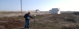
Originally, the observatory consisted of a magnetograph house and a wooden pagoda upon which absolute observations were made. Two further pagodas were added in 1926 and 1932 for the testing and standardising of magnetic instruments.
During the Second World War, Abinger became the site of much of the important work previously carried out at Greenwich. It was also a key part of the effort to reduce the magnetic fields of British ships in order to protect them from magnetically tripped mines.
In 1957, growing magnetic interference from the electrification of local railways forced the relocation of the magnetic observatory to Hartland in Devon. Hartland observatory still operates today.
The BGS possesses records from Abinger observatory from 1924 to 1957.
Statistics
Geographic Coordinates:
| 51° 11´ N | 0° 23´ W |
Elevation: 244m above mean sea level
Data
https://www.bgs.ac.uk/information-hub/scanned-records/magnetograms/ https://wdc.bgs.ac.uk/dataportal/
Mapping data licensed from Ordnance Survey with the permission of
HMSO Crown copyright.
All rights reserved. Licence Number: 100017897/2015